- 堪萨斯州

堪萨斯州
历史
 堪萨斯州州徽
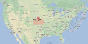 堪萨斯州(3)13~16世纪大批印第安人曾在里帕布利肯河和布鲁河流域建立农业社区。1541年西班牙探险家科罗纳多为寻找黄金到此。1682年此地归法国所有,法国皮毛商与印第安人在此进行频繁交易。1803年根据购买路易斯安那协议让给美国。1803 年归属美国。1861年建州后加入联邦,为美国第34州。
一八三一年开始殖民。一八六一年一月二十九日成为美国第三十四州。以向日葵花(Sunflower)为州花。堪萨斯州别名叫做“向日葵之州”Sunflower-State。堪萨斯州箴言:“排除万难,追求幸福”To the Stars through Difficulties.
州内大专学院有五三所,其中以堪萨斯大学(University of Kansas)为最著名。它位于州府以东之罗伦斯Lawrence,创于一八六四年,学生约两万。另外几所州内著名大学为堪萨斯州立大学(Kansas State University)、福特海斯州立大学(Fort Hays State University)和维契托州立大学(Wichita State University)。
堪萨斯州(Kansas)是美国中部的一个州,位于美国本土的正中心,州名来自印地安苏族的语言,代表了“南风之人”(People of the south wind)邮政编号是KS。堪萨斯州是首个赋予非裔美国人选举权的州。[1]
地理位置
堪萨斯州位于美国大陆 四十八州地理中心。北界内布拉斯加州。南邻俄克拉荷马州。西接科罗拉多州。东与密苏里州毗连。
堪萨斯州位于美国大陆中部。北界内布拉斯加州。南邻俄克拉荷马州。西接科罗拉多州。东与密苏里州毗连。堪萨斯州气候,冬季内已无刺骨的寒风夏季内却有薰人的暖风(墨西哥湾暖气流北上)。降雨量中等。
地形
 堪萨斯州的密西西比河卫星地图由西北角到东南角可分三区:
(A)西部是高平原,面积最大,约占本州面积三分之二,高度有一千多公尺,地面已被切割,出现沟谷丘陵。
(B)东北部冰碛区,面积很小,也被切割。
(C)东南部是大平原区,高度只有二百公尺。
全州地势西高东低,大部地区是广阔坦荡的高平原,是地势平坦而没有树木生长的地区,其中有河谷、小溪及峡谷,平均海拔610米。许多小丘陵高出平原面30~100米,如东部的弗林特丘陵,西部的斯莫基丘陵及雷德丘陵。西部靠近科罗拉多州边境的森弗劳尔山(向日葵山)海拔1231米,为全州最高点。弗林特丘陵,意译是燧石丘陵,因往日印第安人在这个丘陵区内寻找燧石,作箭头用而得名。南部靠近俄克拉何马州的弗迪格里斯河谷海拔213米,为全境最低点。
气候
 堪萨斯州龙卷风(2)堪萨斯州属温带大陆性气候,有严冬酷暑,温差变化大,但时间不长。1月平均气温-3~1℃,7月平均气温24~27℃。年平均气温为13℃。生长期从4月中旬到9月中旬,年平均降水量东南部为1000毫米,西部为500毫米。堪萨斯全州的平均降水量约690毫米。西部降水集中在夏季,常有旱灾和沙暴天气。
堪萨斯州以天气晴朗而闻名,堪萨斯州每年有超过275天以上的晴天。
河流
大多数河流自西向东流。北部属堪萨斯河流域,重要支流有布鲁河、里帕布利肯河、所罗门河、萨林河和斯莫基希尔河。南部属阿肯色河流域,主要支流有锡马隆河、弗迪格里斯河、尼欧肖河和梅里德辛河。堪萨斯东北边界的一角是密西西比河。本州河流由于地面向东南倾斜,适合筑灌溉渠,已建有数百座小型人造湖。
行政区划
| County | FIPS code | County seat | Established | Origin | Etymology | County Code | Population | Area | Map |
|---|---|---|---|---|---|---|---|---|---|
| Allen County | 001 | Iola | 1855 | One of the original 36 counties | William Allen,U.S. SenatorfromOhioand prominent supporter of westward expansion | AL | 13,319 | 503sqmi (1,303km) |
|
| Anderson County | 003 | Garnett | 1855 | One of the original 36 counties | Joseph C. Anderson, Kansas territorial legislator andBorder Ruffianduring "Bleeding Kansas" | AN | 7,917 | 583sqmi (1,510km) |
|
| Atchison County | 005 | Atchison | 1855 | One of the original 36 counties | David Rice Atchison, U.S. Senator fromMissouriand Border Ruffian during "Bleeding Kansas" | AT | 16,813 | 432sqmi (1,119km) |
|
| Barber County | 007 | Medicine Lodge | 1867 | From unorganized area | Thomas W. Barber, prominentFree-Staterkilled in theWakarusa War | BA | 4,861 | 1,134sqmi (2,937km) |
|
| Barton County | 009 | Great Bend | 1867 | From unorganized area | Clara Barton, founder of theAmerican Red Cross | BT | 27,557 | 894sqmi (2,315km) |
|
| Bourbon County | 011 | Fort Scott | 1855 | One of the original 36 counties | Bourbon County, Kentucky, from which many original settlers hailed | BB | 14,897 | 637sqmi (1,650km) |
|
| Brown County | 013 | Hiawatha | 1855 | One of the original 36 counties (Formerly Browne County) | Albert Gallatin Brown, U.S. Senator fromMississippiand Kansas statehood advocate | BR | 9,881 | 571sqmi (1,479km) |
|
| Butler County | 015 | El Dorado | 1855 | One of the original 36 counties | Andrew Pickens Butler, U.S. Senator fromSouth Carolinaand Kansas statehood advocate | BU | 65,827 | 1,428sqmi (3,699km) |
|
| Chase County | 017 | Cottonwood Falls | 1859 | Formed from Butler and Wise counties | Salmon Portland Chase, U.S. Senator from Ohio and Kansas statehood advocate | CS | 2,757 | 776sqmi (2,010km) |
|
| Chautauqua County | 019 | Sedan | 1875 | Formed from Howard County | Chautauqua County, New York, from which many early settlers hailed | CQ | 3,571 | 642sqmi (1,663km) |
|
| Cherokee County | 021 | Columbus | 1855 | One of the original 36 counties (Formerly McGee County) | Cherokee Native Americans, whose lands borders the county in nearbyIndian Territory | CK | 21,226 | 587sqmi (1,520km) |
|
| Cheyenne County | 023 | Saint Francis | 1873 | From unorganized area | Cheyenne Native Americans, who inhabited the area | CN | 2,678 | 1,020sqmi (2,642km) |
|
| Clark County | 025 | Ashland | 1885 | Formed from Ford County | Charles F. Clarke, Captain in6th Regiment Kansas Volunteer CavalryduringAmerican Civil War | CA | 2,181 | 975sqmi (2,525km) |
|
| Clay County | 027 | Clay Center | 1857 | From unorganized area | Henry Clay, influential U.S. Senator fromKentucky | CY | 8,531 | 644sqmi (1,668km) |
|
| Cloud County | 029 | Concordia | 1866 | Formed from Washington (Formerly Shirley County) | William F. Cloud, Union general in the American Civil War who chiefly fought in Kansas and Missouri | CD | 9,397 | 716sqmi (1,854km) |
|
| Coffey County | 031 | Burlington | 1855 | One of the original 36 counties | A.M. Coffey, territorial legislator and Free-Stater during Bleeding Kansas | CF | 8,502 | 630sqmi (1,632km) |
|
| Comanche County | 033 | Coldwater | 1867 | From unorganized area | Comanche Native Americans, who lived in the area | CM | 1,913 | 788sqmi (2,041km) |
|
| Cowley County | 035 | Winfield | 1867 | Formed from Butler County | Matthew R. Cowley, Union lieutenant and distinguished Civil War hero | CL | 36,288 | 1,126sqmi (2,916km) |
|
| Crawford County | 037 | Girard | 1867 | Bourbon and Cherokee Counties | Samuel J. Crawford, thirdGovernor of Kansas | CR | 39,361 | 593sqmi (1,536km) |
|
| Decatur County | 039 | Oberlin | 1873 | From unorganized area | Stephen Decatur, naval commodore andWar of 1812hero | DC | 2,871 | 894sqmi (2,315km) |
|
| Dickinson County | 041 | Abilene | 1857 | From unorganized area | Daniel Stevens Dickinson, U.S. Senator fromNew Yorkand Kansas statehood advocate | DK | 19,762 | 848sqmi (2,196km) |
|
| Doniphan County | 043 | Troy | 1855 | One of the original 36 counties | Alexander William Doniphan,Mexican-American Warhero and pro-slavery sympathizer in "Bleeding Kansas" | DP | 7,864 | 392sqmi (1,015km) |
|
| Douglas County | 045 | Lawrence | 1855 | One of the original 36 counties | Stephen Arnold Douglas, U.S. Senator fromIllinoisand advocate for the moderatepopular sovereigntychoice in the Kansas slavery debate | DG | 112,864 | 457sqmi (1,184km) |
|
| Edwards County | 047 | Kinsley | 1874 | Formed from Kiowa County | John H. Edwards,state senatorwho pushed for creation of the county | ED | 2,979 | 622sqmi (1,611km) |
|
| Elk County | 049 | Howard | 1875 | Formed from Howard County | Elk River, which originates in the county | EK | 2,720 | 648sqmi (1,678km) |
|
| Ellis County | 051 | Hays | 1867 | From unorganized area | George Ellis, Union lieutenant and distinguished Civil War hero | EL | 29,053 | 900sqmi (2,331km) |
|
| Ellsworth County | 053 | Ellsworth | 1867 | From unorganized area | Fort Ellsworth, a Union Civil War outpost in the area | EW | 6,494 | 716sqmi (1,854km) |
|
| Finney County | 055 | Garden City | 1883 | Formed from Arapahoe, Grant, Kearney and Sequoyah Counties | David W. Finney, tenth lieutenant governor of Kansas | FI | 37,200 | 1,300sqmi (3,367km) |
|
| Ford County | 057 | Dodge City | 1867 | From unorganized area | James H. Ford, Union general in the Civil War who mainly fought in Kansas and Missouri | FO | 34,752 | 1,099sqmi (2,846km) |
|
| Franklin County | 059 | Ottawa | 1855 | One of the original 36 counties | Benjamin Franklin, orator, writer, scholar, and founding father of the U.S. | FR | 25,906 | 574sqmi (1,487km) |
|
| Geary County | 061 | Junction City | 1855 | One of the original 36 counties (Formerly Davis County) | John White Geary, Union general in the Civil War who mainly fought in Kansas and Missouri, and who later became Kansas territorial governor | GE | 38,013 | 384sqmi (995km) |
|
| Gove County | 063 | Gove City | 1868 | From unorganized area | Grenville L. Gove, Captain in the11th Regiment Kansas Volunteer Cavalryduring the Civil War | GO | 2,729 | 1,072sqmi (2,776km) |
|
| Graham County | 065 | Hill City | 1867 | From unorganized area | John L. Graham, Union captain and Civil War hero | GH | 2,578 | 898sqmi (2,326km) |
|
| Grant County | 067 | Ulysses | 1888 | Formed from Finney and Hamilton Counties | Ulysses Simpson Grant, commander of Union forces during the Civil War andU.S. President | GT | 7,923 | 575sqmi (1,489km) |
|
| Gray County | 069 | Cimarron | 1887 | Formed from Finney and Ford Counties | Alfred Gray, Kansas Secretary of Agriculture | GY | 6,030 | 869sqmi (2,251km) |
|
| Greeley County | 071 | Tribune | 1873 | From unorganized area | Horace Greeley, publisher of theNew York Tribuneand anti-slavery advocate | GL | 1,298 | 778sqmi (2,015km) |
|
| Greenwood County | 073 | Eureka | 1855 | One of the original 36 counties | Alfred B. Greenwood,U.S. RepresentativefromArkansasand Kansas statehood advocate | GW | 6,454 | 1,140sqmi (2,953km) |
|
| Hamilton County | 075 | Syracuse | 1873 | From unorganized area | Alexander Hamilton, firstU.S. Treasury Secretaryand founding father | HM | 2,639 | 996sqmi (2,580km) |
|
| Harper County | 077 | Anthony | 1867 | From unorganized area | Marion Harper, Union sergeant and Civil War hero | HP | 5,911 | 802sqmi (2,077km) |
|
| Harvey County | 079 | Newton | 1872 | Formed from McPherson, Sedgwick and Reno Counties | James M. Harvey, fifth governor of Kansas | HV | 34,852 | 539sqmi (1,396km) |
|
| Haskell County | 081 | Sublette | 1887 | Formed from Finney and Ford Counties | Dudley Chase Haskell, U.S. Representative from Kansas | HS | 4,256 | 577sqmi (1,494km) |
|
| Hodgeman County | 083 | Jetmore | 1867 | From unorganized area (Formerly Hageman County) | Amos Hodgman, Union captain and Civil War hero | HG | 1,963 | 860sqmi (2,227km) |
|
| Jackson County | 085 | Holton | 1855 | One of the original 36 counties (Formerly Calhoun County) | Andrew Jackson, seventh U.S. President | JA | 13,449 | 657sqmi (1,702km) |
|
| Jefferson County | 087 | Oskaloosa | 1855 | One of the original 36 counties | Thomas Jefferson, third U.S. President and founding father | JF | 18,945 | 536sqmi (1,388km) |
|
| Jewell County | 089 | Mankato | 1867 | From unorganized area | Lewis R. Jewell, Union colonel and Civil War hero | JW | 3,046 | 909sqmi (2,354km) |
|
| Johnson County | 091 | Olathe | 1855 | One of the original 36 counties | Thomas Johnson, Methodistmissionarywho was one of the state's first settlers | JO | 559,913 | 477sqmi (1,235km) |
|
| Kearny County | 093 | Lakin | 1887 | Formed from Finney and Hamilton Counties | Philip Kearny, American general in the Mexican-American and Civil Wars | KE | 3,968 | 870sqmi (2,253km) |
|
| Kingman County | 095 | Kingman | 1872 | Harper and Reno Counties | Samuel A. Kingman, Chief Justice of theKansas Supreme Court | KM | 7,863 | 864sqmi (2,238km) |
|
| Kiowa County | 097 | Greensburg | 1886 | Formed from Comanche and Edwards Counties | Kiowa Native Americans, who inhabited the area | KW | 2,496 | 722sqmi (1,870km) |
|
| Labette County | 099 | Oswego | 1867 | Formed from Neosho County | Pierre La Bette, French fur trapper who formed a peaceful relationship with area natives | LB | 21,284 | 649sqmi (1,681km) |
|
| Lane County | 101 | Dighton | 1873 | From unorganized area | James H. Lane, U.S. Senator from Kansas and Free-Stater during "Bleeding Kansas" | LE | 1,704 | 717sqmi (1,857km) |
|
| Leavenworth County | 103 | Leavenworth | 1855 | One of the original 36 counties | Henry Leavenworth, general in theIndian Warswho established a fort in the area | LV | 77,739 | 463sqmi (1,199km) |
|
| Lincoln County | 105 | Lincoln | 1867 | From unorganized area | Abraham Lincoln, sixteenth U.S. President | LC | 3,174 | 719sqmi (1,862km) |
|
| Linn County | 107 | Mound City | 1855 | One of the original 36 counties | Lewis Fields Linn, U.S. Senator from Kentucky whose family was later involved in the settlement of Kansas | LN | 9,441 | 599sqmi (1,551km) |
|
| Logan County | 109 | Oakley | 1888 | Formed from Wallace County (formerly named St. John County) | John Alexander Logan, prominent Union Civil War general and U.S. Senator from Illinois | LG | 2,784 | 1,073sqmi (2,779km) |
|
| Lyon County | 111 | Emporia | 1855 | One of the original 36 counties (Formerly Breckenridge County) | Nathaniel Lyon, first Union general to be killed in the Civil War | LY | 33,748 | 851sqmi (2,204km) |
|
| Marion County | 115 | Marion | 1860 | From unorganized area | Francis Marion,American Revolutionary Warhero | MN | 12,347 | 943sqmi (2,442km) |
|
| Marshall County | 117 | Marysville | 1855 | One of the original 36 counties | Frank J. Marshall, state representative who became locally known for operating the first ferry over theBig Blue River | MS | 10,022 | 903sqmi (2,339km) |
|
| McPherson County | 113 | McPherson | 1867 | From unorganized area | James Birdseye McPherson, prominent Union Civil War general | MP | 29,356 | 900sqmi (2,331km) |
|
| Meade County | 119 | Meade | 1885 | Formed from Finney, Ford and Seward Counties | George Gordon Meade, Union Civil War general best known for his victory at theBattle of Gettysburg | ME | 4,396 | 978sqmi (2,533km) |
|
| Miami County | 121 | Paola | 1855 | One of the original 36 counties (Formerly Lykins) | Miami Native Americans, who lived in the area | MI | 32,612 | 577sqmi (1,494km) |
|
| Mitchell County | 123 | Beloit | 1867 | From unorganized area | William D. Mitchell, Union captain and Civil War hero | MC | 6,355 | 700sqmi (1,813km) |
|
| Montgomery County | 125 | Independence | 1867 | Formed from Wilson County | Richard Montgomery, Revolutionary War hero | MG | 34,459 | 645sqmi (1,671km) |
|
| Morris County | 127 | Council Grove | 1855 | One of the original 36 counties (Formerly Wise County) | Thomas Morris, U.S. Senator from Ohio and anti-slavery advocate | MR | 5,854 | 697sqmi (1,805km) |
|
| Morton County | 129 | Elkhart | 1886 | Formed from Seward County | Oliver P. Morton,Governor of Indianaand prominent anti-slavery advocate | MT | 3,169 | 730sqmi (1,891km) |
|
| Nemaha County | 131 | Seneca | 1855 | One of the original 36 counties (Formerly Dorn County) | Nemaha River, which passes through the county | NM | 10,132 | 719sqmi (1,862km) |
|
| Neosho County | 133 | Erie | 1855 | One of the original 36 counties (Formerly Dorn County) | Neosho River, which passes through the county | NO | 16,406 | 572sqmi (1,481km) |
|
| Ness County | 135 | Ness City | 1867 | From unorganized area | Noah V. Ness, Corporal in7th Regiment Kansas Volunteer Cavalryduring Civil War | NS | 3,068 | 1,075sqmi (2,784km) |
|
| Norton County | 137 | Norton | 1867 | From unorganized area (Formerly Billings (1873-9) | Orloff Norton, Union captain and Civil War hero | NT | 5,612 | 878sqmi (2,274km) |
|
| Osage County | 139 | Lyndon | 1855 | One of the original 36 counties (Formerly Weller County) | Osage River, which flows through the county | OS | 16,142 | 704sqmi (1,823km) |
|
| Osborne County | 141 | Osborne | 1867 | From unorganized area | Vincent B. Osborne, Union soldier and Civil War hero | OB | 3,806 | 893sqmi (2,313km) |
|
| Ottawa County | 143 | Minneapolis | 1860 | From unorganized area | Ottawa Native Americans, who lived in the area | OT | 6,072 | 721sqmi (1,867km) |
|
| Pawnee County | 145 | Larned | 1867 | From unorganized area | Pawnee Native Americans, who lived in the area | PN | 6,928 | 754sqmi (1,953km) |
|
| Phillips County | 147 | Phillipsburg | 1867 | From unorganized area | William Phillips, state legislator who pushed for creation of the county, and later U.S. Representative | PL | 5,519 | 886sqmi (2,295km) |
|
| Pottawatomie County | 149 | Westmoreland | 1857 | Formed from Calhoun and Riley | Pottawatomie Native Americans, who lived in the area | PT | 22,302 | 844sqmi (2,186km) |
|
| Pratt County | 151 | Pratt | 1867 | From unorganized area | Caleb Pratt, Union lieutenant and Civil War hero | PR | 9,728 | 735sqmi (1,904km) |
|
| Rawlins County | 153 | Atwood | 1873 | From unorganized area | John Aaron Rawlins, prominent Union Civil War general | RA | 2,560 | 1,070sqmi (2,771km) |
|
| Reno County | 155 | Hutchinson | 1867 | From unorganized area | Jesse L. Reno, prominent Union Civil War general | RN | 64,438 | 1,254sqmi (3,248km) |
|
| Republic County | 157 | Belleville | 1868 | Formed from Washington County | Republican River, which flows through the county | RP | 4,858 | 716sqmi (1,854km) |
|
| Rice County | 159 | Lyons | 1867 | From unorganized area | Samuel A. Rice, prominent Union Civil War general | RC | 9,985 | 727sqmi (1,883km) |
|
| Riley County | 161 | Manhattan | 1855 | One of the original 36 counties | Bennett C. Riley, Mexican-American War hero | RL | 75,508 | 610sqmi (1,580km) |
|
| Rooks County | 163 | Stockton | 1867 | From unorganized area | John C. Rooks, Private in11th Regiment Kansas Volunteer Cavalryduring Civil War | RO | 5,223 | 888sqmi (2,300km) |
|
| Rush County | 165 | La Crosse | 1867 | From unorganized area | Alexander Rush, Union captain and Civil War hero | RH | 3,220 | 718sqmi (1,860km) |
|
| Russell County | 167 | Russell | 1867 | From unorganized area | Alva P. Russell, Union captain and Civil War hero | RS | 6,946 | 885sqmi (2,292km) |
|
| Saline County | 169 | Salina | 1860 | From unorganized area | Saline River, which flows through the county | SA | 55,988 | 720sqmi (1,865km) |
|
| Scott County | 171 | Scott City | 1873 | From unorganized area | Winfield Scott, Mexican-American War hero and unsuccessful presidential candidate | SC | 4,937 | 718sqmi (1,860km) |
|
| Sedgwick County | 173 | Wichita | 1867 | Formed from Butler County | John Sedgwick, highest ranking Union general killed in the Civil War | SG | 503,889 | 1,000sqmi (2,590km) |
|
| Seward County | 175 | Liberal | 1873 | From unorganized area | William Henry Seward,U.S. Secretary of State | SW | 23,547 | 640sqmi (1,658km) |
|
| Shawnee County | 177 | Topeka | 1855 | One of the original 36 counties | Shawnee Native Americans, who lived in the area | SN | 178,991 | 550sqmi (1,424km) |
|
| Sheridan County | 179 | Hoxie | 1873 | From unorganized area | Philip Henry Sheridan, prominent Union Civil War general | SD | 2,538 | 896sqmi (2,321km) |
|
| Sherman County | 181 | Goodland | 1873 | From unorganized area | William Tecumseh Sherman, prominent Civil War general | SH | 6,113 | 1,056sqmi (2,735km) |
|
| Smith County | 183 | Smith Center | 1867 | From unorganized area | J. Nelson Smith, Union major and Civil War hero | SM | 3,765 | 896sqmi (2,321km) |
|
| Stafford County | 185 | Saint John | 1867 | From unorganized area | Lewis Stafford, Union captain and Civil War hero | SF | 4,358 | 792sqmi (2,051km) |
|
| Stanton County | 187 | Johnson City | 1887 | Formed from Hamilton County | Edwin McMasters Stanton,U.S. Secretary of Warduring the Civil War | ST | 2,175 | 680sqmi (1,761km) |
|
| Stevens County | 189 | Hugoton | 1886 | Formed from Seward County | Thaddeus Stevens, U.S. Representative fromPennsylvaniawho was a leader ofReconstructionpolitics | SV | 5,756 | 728sqmi (1,886km) |
|
| Sumner County | 191 | Wellington | 1867 | Formed from Butler County | Charles Sumner, U.S. Senator fromMassachusettswho was a leader ofReconstructionpolitics | SU | 23,674 | 1,182sqmi (3,061km) |
|
| Thomas County | 193 | Colby | 1873 | From unorganized area | George Henry Thomas, prominent Union Civil War general | TH | 7,941 | 1,075sqmi (2,784km) |
|
| Trego County | 195 | WaKeeney | 1867 | From unorganized area | Edgar P. Trego, Union captain and Civil War hero | TR | 2,986 | 888sqmi (2,300km) |
|
| Wabaunsee County | 197 | Alma | 1855 | One of the original 36 counties (Formerly Richardson County) | Chief Wabaunsee,Potawatomileader | WB | 7,039 | 798sqmi (2,067km) |
|
| Wallace County | 199 | Sharon Springs | 1868 | From unorganized area | W.H.L. Wallace, prominent Union Civil War general | WA | 1,517 | 914sqmi (2,367km) |
|
| Washington County | 201 | Washington | 1857 | From unorganized area | George Washington, first U.S. President and founding father | WS | 5,758 | 898sqmi (2,326km) |
|
| Wichita County | 203 | Leoti | 1873 | From unorganized area | Wichita Native Americans, who lived in the area | WH | 2,256 | 719sqmi (1,862km) |
|
| Wilson County | 205 | Fredonia | 1855 | One of the original 36 counties | Hiero T. Wilson, Union colonel and Civil War hero | WL | 9,105 | 574sqmi (1,487km) |
|
| Woodson County | 207 | Yates Center | 1855 | One of the original 36 counties | Daniel Woodson, five time acting governor of Kansas Territory | WO | 3,278 | 501sqmi (1,298km) |
|
| Wyandotte County | 209 | Kansas City | 1859 | Formed from Leavenworth and Johnson Counties | Wyandotte Native Americans, who lived in the area | WY | 159,129 | 151sqmi (391km) |
资源
| County | FIPS code | County seat | Established | Origin | Etymology | County Code | Population | Area | Map |
|---|---|---|---|---|---|---|---|---|---|
| Allen County | 001 | Iola | 1855 | One of the original 36 counties | William Allen,U.S. SenatorfromOhioand prominent supporter of westward expansion | AL | 13,319 | 503sqmi (1,303km) |
|
| Anderson County | 003 | Garnett | 1855 | One of the original 36 counties | Joseph C. Anderson, Kansas territorial legislator andBorder Ruffianduring "Bleeding Kansas" | AN | 7,917 | 583sqmi (1,510km) |
|
| Atchison County | 005 | Atchison | 1855 | One of the original 36 counties | David Rice Atchison, U.S. Senator fromMissouriand Border Ruffian during "Bleeding Kansas" | AT | 16,813 | 432sqmi (1,119km) |
|
| Barber County | 007 | Medicine Lodge | 1867 | From unorganized area | Thomas W. Barber, prominentFree-Staterkilled in theWakarusa War | BA | 4,861 | 1,134sqmi (2,937km) |
|
| Barton County | 009 | Great Bend | 1867 | From unorganized area | Clara Barton, founder of theAmerican Red Cross | BT | 27,557 | 894sqmi (2,315km) |
|
| Bourbon County | 011 | Fort Scott | 1855 | One of the original 36 counties | Bourbon County, Kentucky, from which many original settlers hailed | BB | 14,897 | 637sqmi (1,650km) |
|
| Brown County | 013 | Hiawatha | 1855 | One of the original 36 counties (Formerly Browne County) | Albert Gallatin Brown, U.S. Senator fromMississippiand Kansas statehood advocate | BR | 9,881 | 571sqmi (1,479km) |
|
| Butler County | 015 | El Dorado | 1855 | One of the original 36 counties | Andrew Pickens Butler, U.S. Senator fromSouth Carolinaand Kansas statehood advocate | BU | 65,827 | 1,428sqmi (3,699km) |
|
| Chase County | 017 | Cottonwood Falls | 1859 | Formed from Butler and Wise counties | Salmon Portland Chase, U.S. Senator from Ohio and Kansas statehood advocate | CS | 2,757 | 776sqmi (2,010km) |
|
| Chautauqua County | 019 | Sedan | 1875 | Formed from Howard County | Chautauqua County, New York, from which many early settlers hailed | CQ | 3,571 | 642sqmi (1,663km) |
|
| Cherokee County | 021 | Columbus | 1855 | One of the original 36 counties (Formerly McGee County) | Cherokee Native Americans, whose lands borders the county in nearbyIndian Territory | CK | 21,226 | 587sqmi (1,520km) |
|
| Cheyenne County | 023 | Saint Francis | 1873 | From unorganized area | Cheyenne Native Americans, who inhabited the area | CN | 2,678 | 1,020sqmi (2,642km) |
|
| Clark County | 025 | Ashland | 1885 | Formed from Ford County | Charles F. Clarke, Captain in6th Regiment Kansas Volunteer CavalryduringAmerican Civil War | CA | 2,181 | 975sqmi (2,525km) |
|
| Clay County | 027 | Clay Center | 1857 | From unorganized area | Henry Clay, influential U.S. Senator fromKentucky | CY | 8,531 | 644sqmi (1,668km) |
|
| Cloud County | 029 | Concordia | 1866 | Formed from Washington (Formerly Shirley County) | William F. Cloud, Union general in the American Civil War who chiefly fought in Kansas and Missouri | CD | 9,397 | 716sqmi (1,854km) |
|
| Coffey County | 031 | Burlington | 1855 | One of the original 36 counties | A.M. Coffey, territorial legislator and Free-Stater during Bleeding Kansas | CF | 8,502 | 630sqmi (1,632km) |
|
| Comanche County | 033 | Coldwater | 1867 | From unorganized area | Comanche Native Americans, who lived in the area | CM | 1,913 | 788sqmi (2,041km) |
|
| Cowley County | 035 | Winfield | 1867 | Formed from Butler County | Matthew R. Cowley, Union lieutenant and distinguished Civil War hero | CL | 36,288 | 1,126sqmi (2,916km) |
|
| Crawford County | 037 | Girard | 1867 | Bourbon and Cherokee Counties | Samuel J. Crawford, thirdGovernor of Kansas | CR | 39,361 | 593sqmi (1,536km) |
|
| Decatur County | 039 | Oberlin | 1873 | From unorganized area | Stephen Decatur, naval commodore andWar of 1812hero | DC | 2,871 | 894sqmi (2,315km) |
|
| Dickinson County | 041 | Abilene | 1857 | From unorganized area | Daniel Stevens Dickinson, U.S. Senator fromNew Yorkand Kansas statehood advocate | DK | 19,762 | 848sqmi (2,196km) |
|
| Doniphan County | 043 | Troy | 1855 | One of the original 36 counties | Alexander William Doniphan,Mexican-American Warhero and pro-slavery sympathizer in "Bleeding Kansas" | DP | 7,864 | 392sqmi (1,015km) |
|
| Douglas County | 045 | Lawrence | 1855 | One of the original 36 counties | Stephen Arnold Douglas, U.S. Senator fromIllinoisand advocate for the moderatepopular sovereigntychoice in the Kansas slavery debate | DG | 112,864 | 457sqmi (1,184km) |
|
| Edwards County | 047 | Kinsley | 1874 | Formed from Kiowa County | John H. Edwards,state senatorwho pushed for creation of the county | ED | 2,979 | 622sqmi (1,611km) |
|
| Elk County | 049 | Howard | 1875 | Formed from Howard County | Elk River, which originates in the county | EK | 2,720 | 648sqmi (1,678km) |
|
| Ellis County | 051 | Hays | 1867 | From unorganized area | George Ellis, Union lieutenant and distinguished Civil War hero | EL | 29,053 | 900sqmi (2,331km) |
|
| Ellsworth County | 053 | Ellsworth | 1867 | From unorganized area | Fort Ellsworth, a Union Civil War outpost in the area | EW | 6,494 | 716sqmi (1,854km) |
|
| Finney County | 055 | Garden City | 1883 | Formed from Arapahoe, Grant, Kearney and Sequoyah Counties | David W. Finney, tenth lieutenant governor of Kansas | FI | 37,200 | 1,300sqmi (3,367km) |
|
| Ford County | 057 | Dodge City | 1867 | From unorganized area | James H. Ford, Union general in the Civil War who mainly fought in Kansas and Missouri | FO | 34,752 | 1,099sqmi (2,846km) |
|
| Franklin County | 059 | Ottawa | 1855 | One of the original 36 counties | Benjamin Franklin, orator, writer, scholar, and founding father of the U.S. | FR | 25,906 | 574sqmi (1,487km) |
|
| Geary County | 061 | Junction City | 1855 | One of the original 36 counties (Formerly Davis County) | John White Geary, Union general in the Civil War who mainly fought in Kansas and Missouri, and who later became Kansas territorial governor | GE | 38,013 | 384sqmi (995km) |
|
| Gove County | 063 | Gove City | 1868 | From unorganized area | Grenville L. Gove, Captain in the11th Regiment Kansas Volunteer Cavalryduring the Civil War | GO | 2,729 | 1,072sqmi (2,776km) |
|
| Graham County | 065 | Hill City | 1867 | From unorganized area | John L. Graham, Union captain and Civil War hero | GH | 2,578 | 898sqmi (2,326km) |
|
| Grant County | 067 | Ulysses | 1888 | Formed from Finney and Hamilton Counties | Ulysses Simpson Grant, commander of Union forces during the Civil War andU.S. President | GT | 7,923 | 575sqmi (1,489km) |
|
| Gray County | 069 | Cimarron | 1887 | Formed from Finney and Ford Counties | Alfred Gray, Kansas Secretary of Agriculture | GY | 6,030 | 869sqmi (2,251km) |
|
| Greeley County | 071 | Tribune | 1873 | From unorganized area | Horace Greeley, publisher of theNew York Tribuneand anti-slavery advocate | GL | 1,298 | 778sqmi (2,015km) |
|
| Greenwood County | 073 | Eureka | 1855 | One of the original 36 counties | Alfred B. Greenwood,U.S. RepresentativefromArkansasand Kansas statehood advocate | GW | 6,454 | 1,140sqmi (2,953km) |
|
| Hamilton County | 075 | Syracuse | 1873 | From unorganized area | Alexander Hamilton, firstU.S. Treasury Secretaryand founding father | HM | 2,639 | 996sqmi (2,580km) |
|
| Harper County | 077 | Anthony | 1867 | From unorganized area | Marion Harper, Union sergeant and Civil War hero | HP | 5,911 | 802sqmi (2,077km) |
|
| Harvey County | 079 | Newton | 1872 | Formed from McPherson, Sedgwick and Reno Counties | James M. Harvey, fifth governor of Kansas | HV | 34,852 | 539sqmi (1,396km) |
|
| Haskell County | 081 | Sublette | 1887 | Formed from Finney and Ford Counties | Dudley Chase Haskell, U.S. Representative from Kansas | HS | 4,256 | 577sqmi (1,494km) |
|
| Hodgeman County | 083 | Jetmore | 1867 | From unorganized area (Formerly Hageman County) | Amos Hodgman, Union captain and Civil War hero | HG | 1,963 | 860sqmi (2,227km) |
|
| Jackson County | 085 | Holton | 1855 | One of the original 36 counties (Formerly Calhoun County) | Andrew Jackson, seventh U.S. President | JA | 13,449 | 657sqmi (1,702km) |
|
| Jefferson County | 087 | Oskaloosa | 1855 | One of the original 36 counties | Thomas Jefferson, third U.S. President and founding father | JF | 18,945 | 536sqmi (1,388km) |
|
| Jewell County | 089 | Mankato | 1867 | From unorganized area | Lewis R. Jewell, Union colonel and Civil War hero | JW | 3,046 | 909sqmi (2,354km) |
|
| Johnson County | 091 | Olathe | 1855 | One of the original 36 counties | Thomas Johnson, Methodistmissionarywho was one of the state's first settlers | JO | 559,913 | 477sqmi (1,235km) |
|
| Kearny County | 093 | Lakin | 1887 | Formed from Finney and Hamilton Counties | Philip Kearny, American general in the Mexican-American and Civil Wars | KE | 3,968 | 870sqmi (2,253km) |
|
| Kingman County | 095 | Kingman | 1872 | Harper and Reno Counties | Samuel A. Kingman, Chief Justice of theKansas Supreme Court | KM | 7,863 | 864sqmi (2,238km) |
|
| Kiowa County | 097 | Greensburg | 1886 | Formed from Comanche and Edwards Counties | Kiowa Native Americans, who inhabited the area | KW | 2,496 | 722sqmi (1,870km) |
|
| Labette County | 099 | Oswego | 1867 | Formed from Neosho County | Pierre La Bette, French fur trapper who formed a peaceful relationship with area natives | LB | 21,284 | 649sqmi (1,681km) |
|
| Lane County | 101 | Dighton | 1873 | From unorganized area | James H. Lane, U.S. Senator from Kansas and Free-Stater during "Bleeding Kansas" | LE | 1,704 | 717sqmi (1,857km) |
|
| Leavenworth County | 103 | Leavenworth | 1855 | One of the original 36 counties | Henry Leavenworth, general in theIndian Warswho established a fort in the area | LV | 77,739 | 463sqmi (1,199km) |
|
| Lincoln County | 105 | Lincoln | 1867 | From unorganized area | Abraham Lincoln, sixteenth U.S. President | LC | 3,174 | 719sqmi (1,862km) |
|
| Linn County | 107 | Mound City | 1855 | One of the original 36 counties | Lewis Fields Linn, U.S. Senator from Kentucky whose family was later involved in the settlement of Kansas | LN | 9,441 | 599sqmi (1,551km) |
|
| Logan County | 109 | Oakley | 1888 | Formed from Wallace County (formerly named St. John County) | John Alexander Logan, prominent Union Civil War general and U.S. Senator from Illinois | LG | 2,784 | 1,073sqmi (2,779km) |
|
| Lyon County | 111 | Emporia | 1855 | One of the original 36 counties (Formerly Breckenridge County) | Nathaniel Lyon, first Union general to be killed in the Civil War | LY | 33,748 | 851sqmi (2,204km) |
|
| Marion County | 115 | Marion | 1860 | From unorganized area | Francis Marion,American Revolutionary Warhero | MN | 12,347 | 943sqmi (2,442km) |
|
| Marshall County | 117 | Marysville | 1855 | One of the original 36 counties | Frank J. Marshall, state representative who became locally known for operating the first ferry over theBig Blue River | MS | 10,022 | 903sqmi (2,339km) |
|
| McPherson County | 113 | McPherson | 1867 | From unorganized area | James Birdseye McPherson, prominent Union Civil War general | MP | 29,356 | 900sqmi (2,331km) |
|
| Meade County | 119 | Meade | 1885 | Formed from Finney, Ford and Seward Counties | George Gordon Meade, Union Civil War general best known for his victory at theBattle of Gettysburg | ME | 4,396 | 978sqmi (2,533km) |
|
| Miami County | 121 | Paola | 1855 | One of the original 36 counties (Formerly Lykins) | Miami Native Americans, who lived in the area | MI | 32,612 | 577sqmi (1,494km) |
|
| Mitchell County | 123 | Beloit | 1867 | From unorganized area | William D. Mitchell, Union captain and Civil War hero | MC | 6,355 | 700sqmi (1,813km) |
|
| Montgomery County | 125 | Independence | 1867 | Formed from Wilson County | Richard Montgomery, Revolutionary War hero | MG | 34,459 | 645sqmi (1,671km) |
|
| Morris County | 127 | Council Grove | 1855 | One of the original 36 counties (Formerly Wise County) | Thomas Morris, U.S. Senator from Ohio and anti-slavery advocate | MR | 5,854 | 697sqmi (1,805km) |
|
| Morton County | 129 | Elkhart | 1886 | Formed from Seward County | Oliver P. Morton,Governor of Indianaand prominent anti-slavery advocate | MT | 3,169 | 730sqmi (1,891km) |
|
| Nemaha County | 131 | Seneca | 1855 | One of the original 36 counties (Formerly Dorn County) | Nemaha River, which passes through the county | NM | 10,132 | 719sqmi (1,862km) |
|
| Neosho County | 133 | Erie | 1855 | One of the original 36 counties (Formerly Dorn County) | Neosho River, which passes through the county | NO | 16,406 | 572sqmi (1,481km) |
|
| Ness County | 135 | Ness City | 1867 | From unorganized area | Noah V. Ness, Corporal in7th Regiment Kansas Volunteer Cavalryduring Civil War | NS | 3,068 | 1,075sqmi (2,784km) |
|
| Norton County | 137 | Norton | 1867 | From unorganized area (Formerly Billings (1873-9) | Orloff Norton, Union captain and Civil War hero | NT | 5,612 | 878sqmi (2,274km) |
|
| Osage County | 139 | Lyndon | 1855 | One of the original 36 counties (Formerly Weller County) | Osage River, which flows through the county | OS | 16,142 | 704sqmi (1,823km) |
|
| Osborne County | 141 | Osborne | 1867 | From unorganized area | Vincent B. Osborne, Union soldier and Civil War hero | OB | 3,806 | 893sqmi (2,313km) |
|
| Ottawa County | 143 | Minneapolis | 1860 | From unorganized area | Ottawa Native Americans, who lived in the area | OT | 6,072 | 721sqmi (1,867km) |
|
| Pawnee County | 145 | Larned | 1867 | From unorganized area | Pawnee Native Americans, who lived in the area | PN | 6,928 | 754sqmi (1,953km) |
|
| Phillips County | 147 | Phillipsburg | 1867 | From unorganized area | William Phillips, state legislator who pushed for creation of the county, and later U.S. Representative | PL | 5,519 | 886sqmi (2,295km) |
|
| Pottawatomie County | 149 | Westmoreland | 1857 | Formed from Calhoun and Riley | Pottawatomie Native Americans, who lived in the area | PT | 22,302 | 844sqmi (2,186km) |
|
| Pratt County | 151 | Pratt | 1867 | From unorganized area | Caleb Pratt, Union lieutenant and Civil War hero | PR | 9,728 | 735sqmi (1,904km) |
|
| Rawlins County | 153 | Atwood | 1873 | From unorganized area | John Aaron Rawlins, prominent Union Civil War general | RA | 2,560 | 1,070sqmi (2,771km) |
|
| Reno County | 155 | Hutchinson | 1867 | From unorganized area | Jesse L. Reno, prominent Union Civil War general | RN | 64,438 | 1,254sqmi (3,248km) |
|
| Republic County | 157 | Belleville | 1868 | Formed from Washington County | Republican River, which flows through the county | RP | 4,858 | 716sqmi (1,854km) |
|
| Rice County | 159 | Lyons | 1867 | From unorganized area | Samuel A. Rice, prominent Union Civil War general | RC | 9,985 | 727sqmi (1,883km) |
|
| Riley County | 161 | Manhattan | 1855 | One of the original 36 counties | Bennett C. Riley, Mexican-American War hero | RL | 75,508 | 610sqmi (1,580km) |
|
| Rooks County | 163 | Stockton | 1867 | From unorganized area | John C. Rooks, Private in11th Regiment Kansas Volunteer Cavalryduring Civil War | RO | 5,223 | 888sqmi (2,300km) |
|
| Rush County | 165 | La Crosse | 1867 | From unorganized area | Alexander Rush, Union captain and Civil War hero | RH | 3,220 | 718sqmi (1,860km) |
|
| Russell County | 167 | Russell | 1867 | From unorganized area | Alva P. Russell, Union captain and Civil War hero | RS | 6,946 | 885sqmi (2,292km) |
|
| Saline County | 169 | Salina | 1860 | From unorganized area | Saline River, which flows through the county | SA | 55,988 | 720sqmi (1,865km) |
|
| Scott County | 171 | Scott City | 1873 | From unorganized area | Winfield Scott, Mexican-American War hero and unsuccessful presidential candidate | SC | 4,937 | 718sqmi (1,860km) |
|
| Sedgwick County | 173 | Wichita | 1867 | Formed from Butler County | John Sedgwick, highest ranking Union general killed in the Civil War | SG | 503,889 | 1,000sqmi (2,590km) |
|
| Seward County | 175 | Liberal | 1873 | From unorganized area | William Henry Seward,U.S. Secretary of State | SW | 23,547 | 640sqmi (1,658km) |
|
| Shawnee County | 177 | Topeka | 1855 | One of the original 36 counties | Shawnee Native Americans, who lived in the area | SN | 178,991 | 550sqmi (1,424km) |
|
| Sheridan County | 179 | Hoxie | 1873 | From unorganized area | Philip Henry Sheridan, prominent Union Civil War general | SD | 2,538 | 896sqmi (2,321km) |
|
| Sherman County | 181 | Goodland | 1873 | From unorganized area | William Tecumseh Sherman, prominent Civil War general | SH | 6,113 | 1,056sqmi (2,735km) |
|
| Smith County | 183 | Smith Center | 1867 | From unorganized area | J. Nelson Smith, Union major and Civil War hero | SM | 3,765 | 896sqmi (2,321km) |
|
| Stafford County | 185 | Saint John | 1867 | From unorganized area | Lewis Stafford, Union captain and Civil War hero | SF | 4,358 | 792sqmi (2,051km) |
|
| Stanton County | 187 | Johnson City | 1887 | Formed from Hamilton County | Edwin McMasters Stanton,U.S. Secretary of Warduring the Civil War | ST | 2,175 | 680sqmi (1,761km) |
|
| Stevens County | 189 | Hugoton | 1886 | Formed from Seward County | Thaddeus Stevens, U.S. Representative fromPennsylvaniawho was a leader ofReconstructionpolitics | SV | 5,756 | 728sqmi (1,886km) |
|
| Sumner County | 191 | Wellington | 1867 | Formed from Butler County | Charles Sumner, U.S. Senator fromMassachusettswho was a leader ofReconstructionpolitics | SU | 23,674 | 1,182sqmi (3,061km) |
|
| Thomas County | 193 | Colby | 1873 | From unorganized area | George Henry Thomas, prominent Union Civil War general | TH | 7,941 | 1,075sqmi (2,784km) |
|
| Trego County | 195 | WaKeeney | 1867 | From unorganized area | Edgar P. Trego, Union captain and Civil War hero | TR | 2,986 | 888sqmi (2,300km) |
|
| Wabaunsee County | 197 | Alma | 1855 | One of the original 36 counties (Formerly Richardson County) | Chief Wabaunsee,Potawatomileader | WB | 7,039 | 798sqmi (2,067km) |
|
| Wallace County | 199 | Sharon Springs | 1868 | From unorganized area | W.H.L. Wallace, prominent Union Civil War general | WA | 1,517 | 914sqmi (2,367km) |
|
| Washington County | 201 | Washington | 1857 | From unorganized area | George Washington, first U.S. President and founding father | WS | 5,758 | 898sqmi (2,326km) |
|
| Wichita County | 203 | Leoti | 1873 | From unorganized area | Wichita Native Americans, who lived in the area | WH | 2,256 | 719sqmi (1,862km) |
|
| Wilson County | 205 | Fredonia | 1855 | One of the original 36 counties | Hiero T. Wilson, Union colonel and Civil War hero | WL | 9,105 | 574sqmi (1,487km) |
|
| Woodson County | 207 | Yates Center | 1855 | One of the original 36 counties | Daniel Woodson, five time acting governor of Kansas Territory | WO | 3,278 | 501sqmi (1,298km) |
|
| Wyandotte County | 209 | Kansas City | 1859 | Formed from Leavenworth and Johnson Counties | Wyandotte Native Americans, who lived in the area | WY | 159,129 | 151sqmi (391km) |
人口
堪萨斯州河流由于地面向东南倾斜,适合筑灌溉渠,已建有数百座小型人造湖。主要作物是冬小麦,被誉为世界早餐之州(因为美国小麦销欧、亚、非二州)。其次为芦黍。矿产有石油及天然气,产量均富。在堪萨斯州中部之奥提斯有世界最大之制氦工厂。
经济
根据最新的人口普查,堪萨斯州有2,893,957(2013年)。堪萨斯州的种族比例可分为:
83.1%是白人、7%是拉美裔人、5.7%非裔美国人、1.7%是亚裔美国人、0.9%是印地安原住民、2.1 %混合的种族。
堪萨斯州的前五大居民祖先为:德国人(25.9%)、爱尔兰人(11.5%)、英国人(10.8%)、美国人 (8.8%) 、非裔美国人(5.7%)。[1]
文化
堪萨斯州是全美重要的农牧业州,著名的通讯公司Sprint Nextel总部即位于堪萨斯州。
农业和制造业是堪萨斯州经济的两大支柱,前者为后者提供大部分原料。农牧总产值在50州内列第7位,全州有农牧场86000个,农场面积占全州80%,属小麦带,小麦产量居全国之冠,有美国“粮仓”之称;高粱占第二位;干草占第四位;牛肉占第四位,猪肉占第八位。牛甚多,约七百万头,在五十州内列第四位。平均每一州民可有牛三头。
威奇托是堪萨斯州最大城市和制造业中心,以食品加工、炼油和小型飞机制造着称;其次是堪萨斯城,是本州东北部工商业城市,牲畜集散和肉类加工中心。横贯大陆铁路和公路通过堪萨斯州,州内外联系方便。设有堪萨斯大学、堪萨斯州立大学等数所院校。
全州有4300家制造厂和加工厂,能生产从飞机到锌铸件等各种产品,威奇托市拥有世界最大的野营用具厂,以生产加热供暖设备、空调设备和履带式雪上汽车著称。其他重要产品有婴儿食品、宠物食品、运输设备、非电气机器制造、活动房屋、拖车房屋、轮胎、颜料和洗碟机。
海斯市(Hays)是堪萨斯州西北方最大的城市,提供堪萨斯州西北区当地居民医疗,教育,和工商业所需。位于该市的福特海斯州立大学(Fort Hays State University)在堪萨斯西北部乃至全州扮演着重要的经济角色,为堪萨斯州提供各方面的人才,促进区域发展。
面粉加工制造业在工业中占重要地位,肉类罐头加工业发展迅速。矿产资源丰富,盛产石油、天然气、烟煤、锌、铅和白垩,产量均富。木材有橡树木及核桃木。在本州中部之奥提斯有世界最大之制氦工厂。[2]
宗教
托皮卡和威奇托两个城市都有交响乐团。位于坎科底亚(Concordia)的布朗大歌剧院、位于劳伦斯的劳伦斯艺术中心及位于威奇托的第二世纪剧院旨有音乐会、戏居及其他的表演。堪萨斯州每年都会举行许多艺术节,像在林兹伯格举行的弥赛亚节、在温尔德举行的核桃谷蓝草节、在曼哈顿举行的堪萨斯州民节。
堪萨斯州的艺术博物馆有:威奇托艺术博物馆、位于堪萨斯州立大学的海伦史本瑟艺术博物馆、劳伦斯艺术中心、位于威奇托州立大学的艾德温尤瑞奇艺术博物馆、位于沃西本恩大学的穆文艺博物馆。堪萨斯州其他的博物馆还有:位于哈奇森(Hutchison)的堪萨斯守宇宙及太空中心、位于威奇托的科学中心、位于霍斯德(Halstead)的堪萨斯健康博物馆、位于堪萨斯大学的人类学博物馆。以及位于海斯(Hays)市福特海斯州立大学(Fort Hays State University)的自然历史博物馆。[3]
教育
 劳伦斯艺术中心宗教上,堪萨斯州居民大多是新教徒。
71% 新教徒(Protestant)、17% 罗马天主教徒(Roman Catholic)、2% 其他基督教徒(Other Christian)、1% 其他宗教教徒(Other Religions)、5% 无信仰(Non-Religious)。
在堪萨斯州的新教徒中,前三大派别为:浸礼会(Baptist):16%、卫理公会(Methodist):15%、路德会(Lutheran):5%。[4]
交通
州立大学
 堪萨斯州立大学堪萨斯大学(University of Kansas)
堪萨斯州立大学(Kansas State University)
福特海斯州立大学(Fort Hays State University)
卫奇塔州立大学(Wichita State University)
商场州立大学(Emporia State University)
匹兹堡州立大学(Pittsburg State University)
其中堪萨斯州立大学位于堪萨斯州曼哈顿市,是堪萨斯州第一所公立大学,也是一所被国际认可的综合性学校,提供优秀的学术课程。特色专业包括建筑学、会计、大众传媒等。
福特海斯州立大学被列入中华人民共和国教育部第一批认可的在中国境内授予境外学士学位的外国学校名单中, 并且在全球30多个国家都有各类合作项目,是堪萨斯州高等教育国际化的先驱。其特色专业为:平面设计、农业科技、领导学、心理学等。[5]
私立大学
帕克大学(Park University)
贝克大学(Baker University)
伯纳狄汀学院(Benedictine College)
贝色尼学院(Bethany College)
贝瑟学院(Bethal College)
朋友大学(Friends University)
堪萨斯纽曼学院(Kansas Newman College)
迈克佛森学院(McPherson College)
渥太华大学(Ottawa University)
圣马莉学院(St. Mary College)
西南学院(Southwestern College)
史德林学院(Sterling College)
泰柏学院(Tabor College)
托贝卡沃西本恩大学(Washburn University of Topeka)
私立高中
| 校名 | 学费 |
|---|---|
| 麦尔学院 (Maur Hill-Mount Academy) | $21,250 |
| 圣约翰军事学校(St. John's Military School) | $34,100 |
| 托马斯摩尔中学(Thomas More Prep-Marian) | $25,000 |
旅游景点
| 校名 | 学费 |
|---|---|
| 麦尔学院 (Maur Hill-Mount Academy) | $21,250 |
| 圣约翰军事学校(St. John's Military School) | $34,100 |
| 托马斯摩尔中学(Thomas More Prep-Marian) | $25,000 |
重要城镇
重要机场
 堪萨斯国际机场堪萨斯市国际机场 Kansas City International Airport, 堪萨斯城
Wichita Mid-Continent Airport, 威奇塔
重要高速公路
35号州际公路
70号州际公路[6]
体育团体
 考夫曼博物馆西南牲畜博览会,六楼博物馆,博览公园,医学展馆,天文馆,堪萨斯立体电影院,非裔美国人博物馆,迪普埃伦现场音乐中心,达拉斯艺术区,达拉斯艺术博物馆,达拉斯别墅,阴谋博物馆,南弗克牧场,太阳舞广场,牲畜围栏国家历史保护区,牲畜博物馆,奇泽姆牛车道壁画,福特渥斯国际机场,六旗主题公园,棒球传奇博物馆,自然科学公园,阿灵顿棒球场,摩天轮。
国家公园
美国中部国家公园
堪萨斯州主要景观:(A)波状起伏的广大麦田(冬小麦)。(B)牧场里到处散布着牛群。(C)农舍之旁建有高耸的谷仓及秣草仓。(D)油田区内有数不清的油井铁架。
词条图册
 堪萨斯州托皮卡托皮卡(Topeka)
威奇塔(Wichita)
曼哈顿Manhattan
莱文沃思Leavenworth
劳伦斯Lawrence
哈钦森Hutchinson
阿比林Abilene


-

成都雷克萨斯IS最高优惠7万元 独具匠心
2025-04-23 20:39:13 查看详情 -
雷克萨斯RZ海外正式上市 15.48万元
2025-04-23 20:39:13 查看详情 -
雷克萨斯RZ海外正式上市 售价约28.96万起
2025-04-23 20:39:13 查看详情 -
成都雷克萨斯IS250最高优惠4万 最新怎么样
2025-04-23 20:39:13 查看详情 -
成都雷克萨斯IS250最高优惠4万 有现车销售
2025-04-23 20:39:13 查看详情 -
英菲尼迪款QX60卓越版上市 雷克萨斯RZ海外正式上市
2025-04-23 20:39:13 查看详情 -
成都雷克萨斯IS250最高优惠4万 个性精致
2025-04-23 20:39:13 查看详情 -
雷克萨斯RZ海外正式上市 首款车型BM
2025-04-23 20:39:13 查看详情 -
广汽丰田新款雷凌将于3月23日上市 雷克萨斯UX
2025-04-23 20:39:13 查看详情 -
雷克萨斯RZ海外正式上市 斯威大虎EDi正式上市
2025-04-23 20:39:13 查看详情

 求购
求购